


 Menu
Menu
Slave Quarters Photo Album
Also see: Slavery in the President's House | The Slave Quarters | The Slave Quarters FAQ
On August 6, 2003, National Park Service archeologist Jed Levin and members of the Independence Hall Association met at the construction site of the Liberty Bell Center (opening date, October 9) to mark off the location of the Slave Quarters of the President's House. IHA (owner of ushistory.org) is the independent, citizens-advisory organization for INHP. This was the first time that the location of the Slave Quarters has been marked since their presumed demolition in the early 19th century. The two rooms were outlined with blue tape and, after extensive photographing, the blue tape was removed.
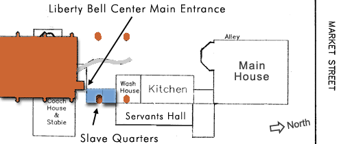
Map showing the locations of the Liberty Bell Center and the President's House. The brown areas represent new construction for the Liberty Bell Center. The gray serpentine wall is also a recent construction. The Slave Quarters are marked in blue.
(Detail of a 2002 National Park Service map, with additions by Ed Lawler.)
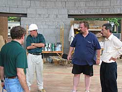
Left to right: NPS archeologist Jed Levin, LBC construction supervisor, IHA historian Ed Lawler, and IHA webmaster Doug Heller, discussing the project ahead.
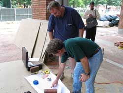
Levin and Lawler consult the 1785 map in preparation for taping out the location of the Slave Quarters.
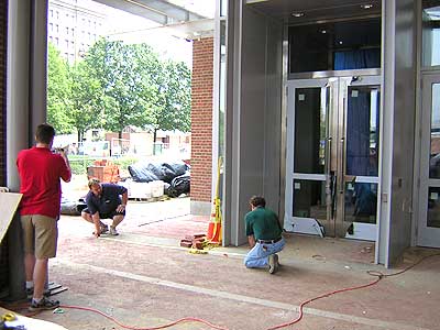
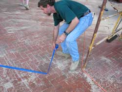
Levin and Lawler measuring out the south wall of the Slave Quarters. At left, photographing, is IHA intern Jonathan Parker.
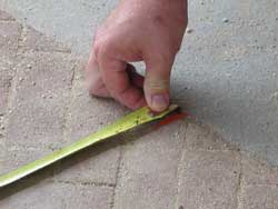
The exact dimensions shown on the 1785 map are measured on the paving of the entrance plaza of the Liberty Bell Center.
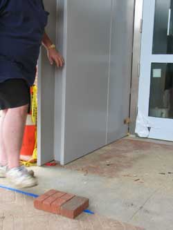
The bricks indicate the southwest corner of the Slave Quarters. The main entrance to the Liberty Bell Center is less than five feet away.
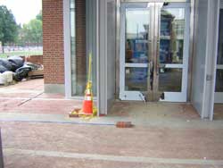
Another view of the southwest corner of the Slave Quarters and the main entrance to the Liberty Bell Center.
Levin taping off the northeast corner of the Slave Quarters
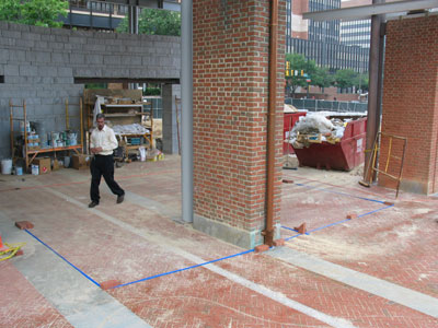
A brick pier for the Liberty Bell Center stands upon the footprint of the Slave Quarters (outlined in blue tape). Photo from the southeast.
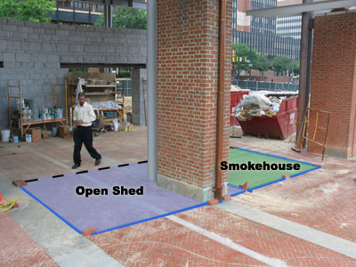
An artist's overlay of the two rooms of the Slave Quarters (Open Shed and Smokehouse) onto the preceding photo. The dotted line matches the dotted line from the 1785 map.
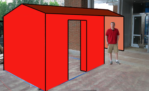
Parker poses outside the main entrance to the Liberty Bell Center. An artist's overlay superimposes the walls and a roof onto the taped outline to suggest the 2-room structure of the Slave Quarters. Photo from the northwest.