
Cornwallis's March: Driving Tour of the Brandywine Battlefield Region
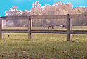
This tour is a leisurely drive through beautiful Brandywine Valley countryside. There are no stores and only one historic marker.
BACKGROUND
September 11, 1777, at 4 a.m., Cornwallis and Howe, along with 12,000 British and Hessian troops set out on a 17-mile march. It was very hot and very foggy that morning before sunrise.
Remember that Washington expected a direct assault across Chadds Ford, and to encourage that belief General Knyphausen was creating as much noise and smoke as possible along the Great Road (today's Route 1) (see Straight-Ahead Tour).
Also remember that Washington had men stationed at every ford along the Brandywine north to Painter's Ford, which he had been informed was the northmost ford within a day's march, and south to Pyle's Ford, deemed too wooded to be a likely crossing spot.
But General Howe knew a route north of Painters' Ford and here's where you will drive today.
The number in the left column is the mileage.
| 0.0 | Start halfway through Kennett Square as you turn right onto Route 82. Set your odometer to zero as you turn the corner. |
| 0.7 | Cross Route 1. Continue straight. Fans of architecture will enjoy the beautiful private homes and public buildings you pass by here. |
| 2.0 | Continue straight across Street Road, Route 926. |
| 3.2 | Enter the traffic circle and take the first right off the circle onto Doe Run Road. |
| 3.5 | At the fork, stay on this road by bearing right. |
| 3.7 | 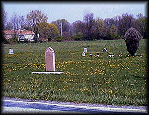 |
| 4.9 |  |
| 5.3 | Left on Northbrook (also called Red Lion). |
| 6.0 | Bend right and stay on Northbrook. |
| 6.3 | At intersection, continue straight. |
| 7.7 | The road ends. Take a left onto Route 842 and immediately... |
| 7.8 | Take a right turn on the continuation of Northbrook. |
| 8.5 |  |
| 8.7 | 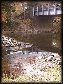 |
| 8.9 | Turn right and continue on Northbrook. |
| 9.6 | Take a right turn on Camp Linden Road. The Brandywine River is on your right. |
| 10.1 | Pass the Philadelphia Ethical Society on your left. |
| 10.3 | Left on Wawaset (pronounced wah-WAH-set). Now we have to take a little detour from the path that was marched as a connecting road has disappeared over time! |
| 10.8 | Right on Cann Road to end (detour from path marched) |
| 11.4 | Right on Strasburg Rd. (detour from path marched) |
| 11.5 | Right on Lucky Hill (detour from path marched) |
| 12.5 | About now you're back on the path marched. Once you pass Barry Road on your right, you are certainly back on track! |
| 13.4 | 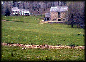 |
| 13.7 | At end of road, left on Allerton Road. |
| 13.9 | 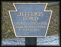  |
| 14.1 | Continue left on 842. |
| 14.2 | Turn right on Birmingham Road. |
| 15.3 | Continue straight across Lenape Rd. at Strode's Mill Gallery (Route 100) |
| 15.9 | Come to the intersection with Country Club Road. There is a historic marker on the rise to your left. There is a scenic overlook you can enjoy, much as General Howe did. Now it's time to reset your odometer and to move on to The "Battle Driving Tour" |